
ATCi’s Flagship Emergency Field Response Package
Functions
- Robust application designed to provide the necessary information to Emergency Management about response crews in the field.
- Mobile applications enable complete end-to-end communication between Emergency Field Response and the EMS dispatch and management teams.
- Mapping features designed to utilize the incredible accuracy of our mapping products – the most accurate in the industry.
Features
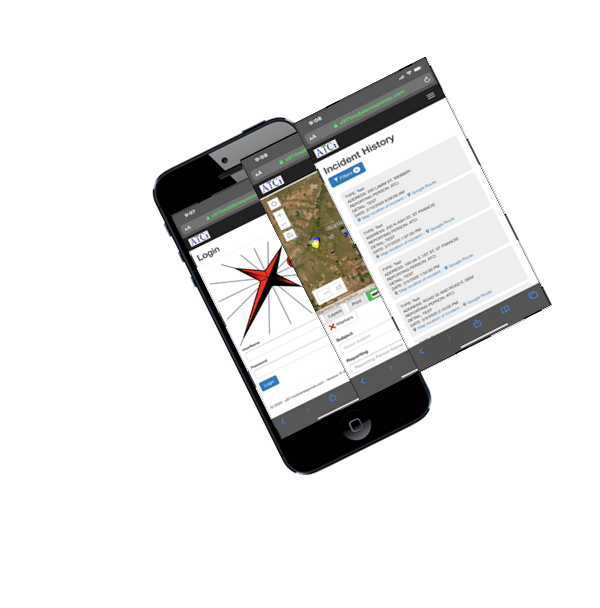
- Windows and mobile compatible Emergency Response platform
- User-managed iOS and Android mobile applications
- SMS notification
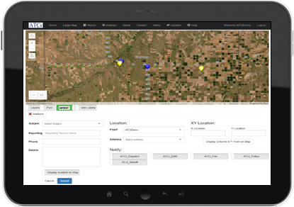
- Routing based off NG9-1-1 GIS data
- Tabs designed and built for individual agencies of the same PSAP
- Law Enforcement
- Fire Department
- Emergency Medical Services
- Emergency Management Offices
- Verizon Connect Live Tracking for deployed responders
- Secure access for authorized personnel
- Integrated What3Words location technology
Our Custom GIS Layers Provides for the Most Accurate Address and Route Data Available
- View current locations of all managed vehicles
- Active
- Non-Active
- PSAP vehicles out-of-area
- Foreign vehicles currently in PSAP geographic area
- Search and display addresses inside and outside of PSAP geographic area
- Complete incident tracking and extensive filtering options
- Google street view of address points, vehicle location, and incidents
- Capability to create, review, and notify incidents.
X911 Demo
Link to Demo Videos while we are still working on demo sites
Customer Stories
Here we will have customer reviews and short stories of how the product has helped.